THE CLAYTON
SILVER PROJECT
USD $660,000,000*
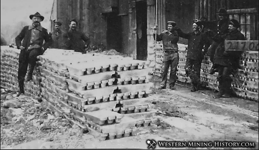
HISTORIC PRODUCTION
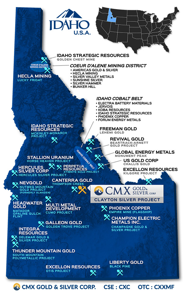
Our Flagship Project (100% Owned)
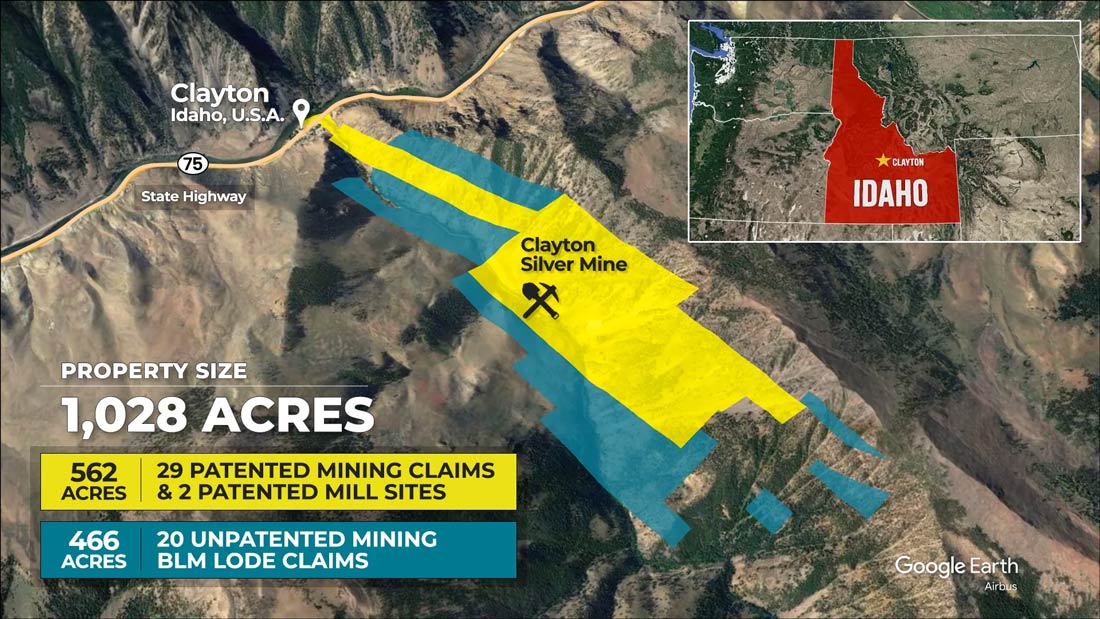
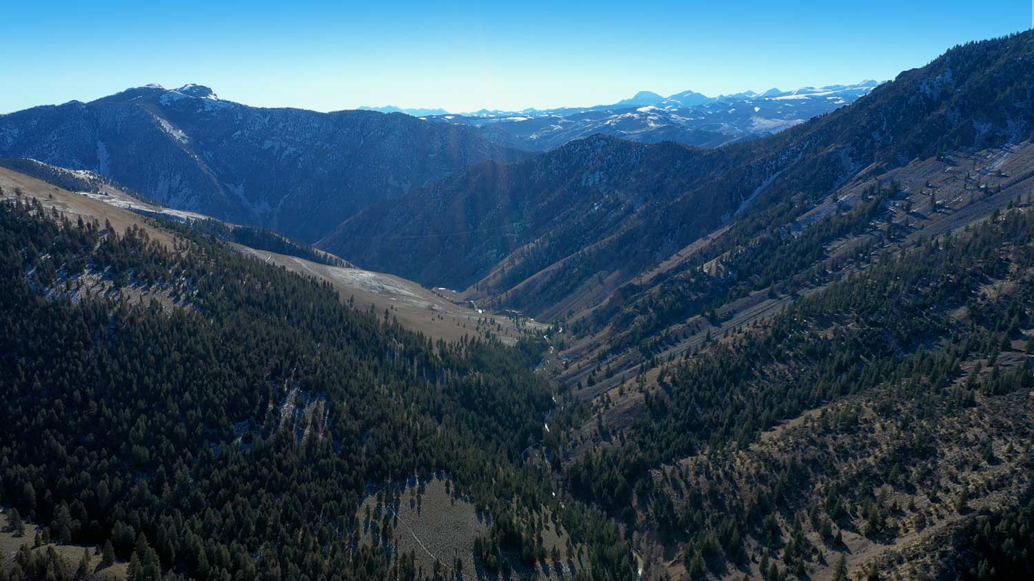
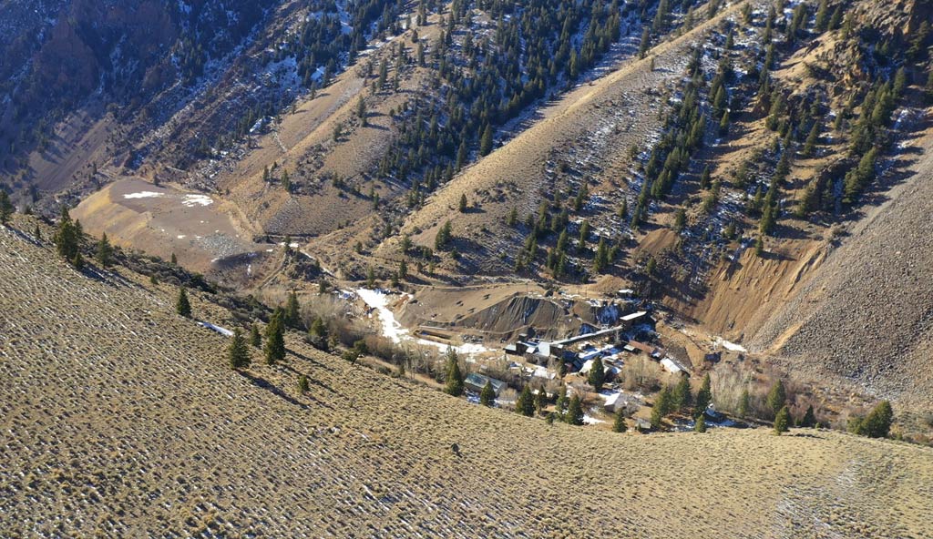
Clayton Silver Project Overview & Locality
The Clayton Silver Mine was discovered in the late 1800’s and historically was one of the most active underground mines in the Bayhorse Mining District in central Idaho for lead, zinc, silver, and copper with minor gold. Based on current spot metal prices the Clayton Mine historical recorded ore production would have been equivalent to approximately USD $660M
Located approximately 30 km south-southwest of Challis in Custer County, central Idaho, the 1,028 acre property consists of 29 patented mining claims and two patented mill sites aggregating approximately 562 acres, and 20 unpatented mining claims adjacent to and surrounding the Company’s patented claims covering an additional 466 acres.
Clayton Silver Project Claim Map
Explore the Property
Project Highlights
- The Clayton Silver Project is a high-quality asset
- Excellent assay results from successful 2023 TOMRA Ore-Sorting test program
- Patented claims include surface ownership rights.
- No government royalties, minimal property maintenance costs.
- No legacy environmental issues.
- Accessible year round; paved road to site
- Idaho is a mining friendly jurisdiction & ranked #7 in the world on the Investment Attractiveness Index
- No drilling permits required for patented claims
- Advanced exploration project has excellent potential for adding resources and deposits.
- Existing data highlights big upside from low risk drilling programs.
- The Clayton Silver Mine is an example of a replacement deposit in carbonate rocks
Additional Info
Idaho is Ranked #7 in the World on the Investment Attractiveness Index
Clayton Mine Historical Information
The historic production disclosed from the Clayton Silver Mine, mainly of silver, lead and zinc, has an aggregate present value of approximately USD $660 million (*based on current spot metals prices). This value is provided for demonstration purposes and is not intended to represent fair value of historical production. The mine operated for several decades, mainly from the 1950s to the mid-1980s and was economic. CMX’s strategy will be to run a mill that has twice or three times the capacity of the old mill, greatly improving economies of scale and increasing the present value of the potential resource.
Previous operators did very little exploration or development drilling to look for other resources. If resources with recoverable metals values several times what has been recovered previously are confirmed through drilling, the enhanced present value of the Clayton Silver Property will increase the enterprise value of CMX substantially
Clayton Mine Recorded Historical Production
| ORE MILLED | SILVER | LEAD | ZINC | COPPER | GOLD |
|---|---|---|---|---|---|
|
Tonnes |
oz |
lb |
lb |
lb |
oz |
|
2,145,000 |
7,031,110 |
86,771,527 |
28,172,211 |
1,664,177 |
1,454 |
|
SPOT METAL PRICE |
$75.00/oz |
$0.90/lb |
$1.42/lb |
$5.80/lb |
$4,455/oz |
*Gross Value:
USD $661,561,000
*Gross Value per Tonne:
USD $308.42
*Silver value is approximately 80% of total metals value. Based on current approximate spot metals prices for demonstration purposes and not intended to represent fair value of historical production. Last updated: December 2025. Historical production data is taken from Hillman, Bob, M.S. Thesis, June 26, 1986, Eastern Washington University.
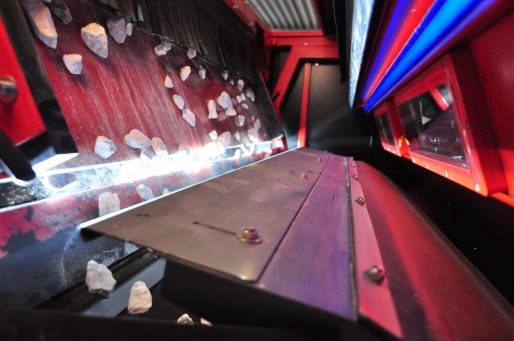
1,000,000 Tonne Mine Stockpile Exploitation Potential
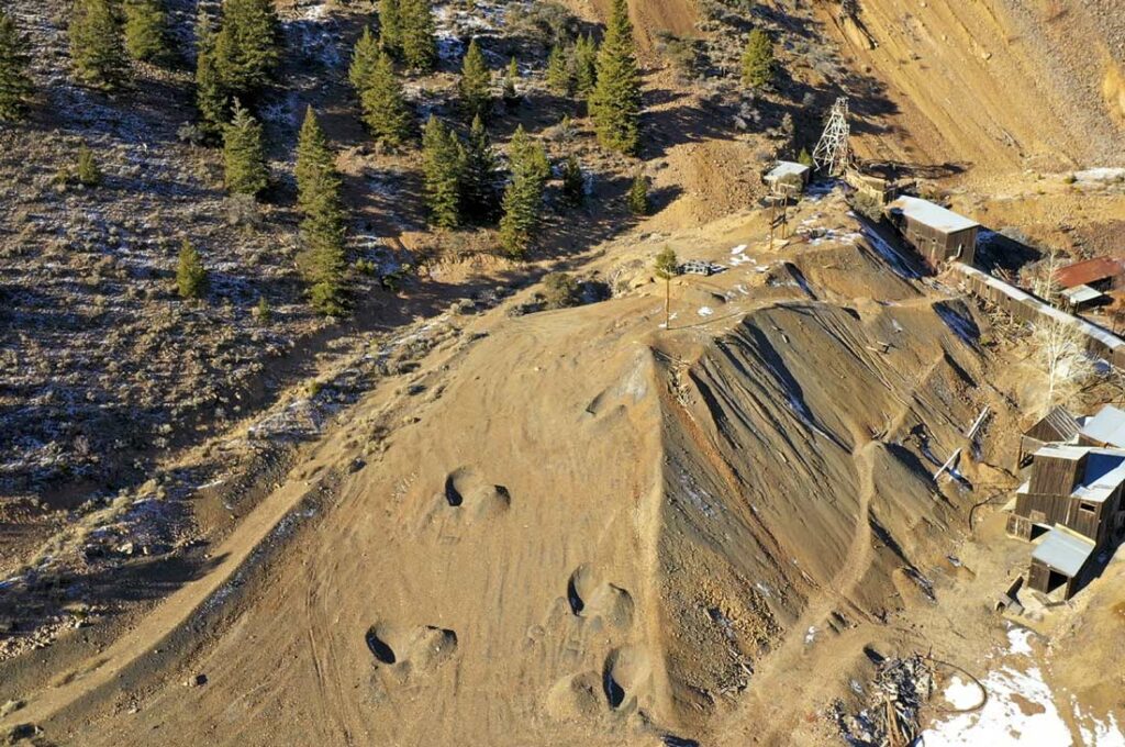
The Clayton Mine stockpile consists of mineralized rock that was not processed through the mill as the grade was not considered high enough at the time it was mined. The stockpile is estimated to contain in excess of 1,000,000 tonnes of mineralized material readily available for immediate processing.
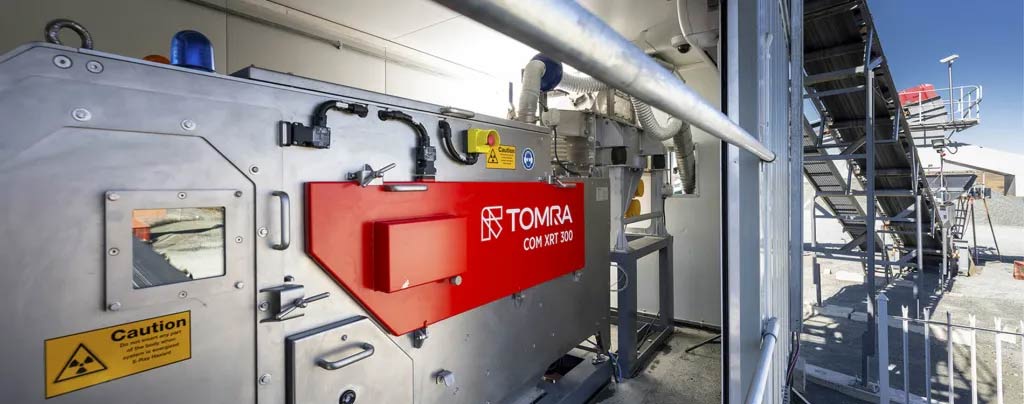
In May 2022, the Company signed an agreement with Sulphide Remediation Inc, a firm specializing in mineral processing utilizing precision X-Ray ore sorting technology to produce high-grade concentrate from mine stockpiles for subsequent delivery to a toll mill.
Compared to average grades documented in the Company’s 2014 stockpile evaluation program , ore-sorting increased the silver grade by 6.4 times and the lead and zinc grades by 7 times. The success of TOMRA’s ore-sorting to enhance the grade of the metals of interest in the stockpile is confirmed by the excellent assay results. Ore-sorting is a proven technology utilized successfully around the world to recover metals from historically mined material. Testing confirmed the Company’s expectation that it would work well on the stockpile material.
Assay Results on the Clayton Stockpile
| SILVER | LEAD | ZINC | COPPER | GOLD |
|---|---|---|---|---|
|
oz/t |
% |
% |
% |
g/t |
|
5.02 |
3.1 |
1.91 |
0.096 |
0.1 |
Increase in XRT Ore Sorting Grades
| SILVER | LEAD | ZINC |
|---|---|---|
540% |
600% |
600% |
1,000,000 Tonne Mine Stockpile Exploitation Potential
The Clayton Mine stockpile consists of mineralized rock that was not processed through the mill as the grade was not considered high enough at the time it was mined. The stockpile is estimated to contain in excess of 1,000,000 tonnes of mineralized material readily available for immediate processing.
In May 2022, the Company signed an agreement with Sulphide Remediation Inc, a firm specializing in mineral processing utilizing precision X-Ray ore sorting technology to produce high-grade concentrate from mine stockpiles for subsequent delivery to a toll mill.
Compared to average grades documented in the Company’s 2014 stockpile evaluation program , ore-sorting increased the silver grade by 6.4 times and the lead and zinc grades by 7 times. The success of TOMRA’s ore-sorting to enhance the grade of the metals of interest in the stockpile is confirmed by the excellent assay results. Ore-sorting is a proven technology utilized successfully around the world to recover metals from historically mined material. Testing confirmed the Company’s expectation that it would work well on the stockpile material.
Assay Results on the Clayton Stockpile
| SILVER | LEAD | ZINC | COPPER | GOLD |
|---|---|---|---|---|
|
oz/t |
% |
% |
% |
g/t |
|
5.02 |
3.1 |
1.91 |
0.096 |
0.1 |
Increase in XRT
Ore Sorting Grades
| SILVER | LEAD | ZINC |
|---|---|---|
540% |
600% |
600% |
Clayton Silver Mine Operations
Historical Data:
- Clayton Mine developed on 8 levels to 1100 ft depth with 19,690 feet of underground development.
- Two major ore bodies developed: “South” & “North”
- Mine records indicate mineable ore in North Ore Body at time of closure
- Additional tonnage down to 1530 ft level not mined.
- Interpretation indicates open to depth additional potential east and west of South Ore Body workings.
Historical Drilling:
- Previous drill holes suggest upside potential
- Confirms North Ore Body mineralization below 1100 ft depth of old mine workings to at least 1500 ft depth.
- 1960s drill hole 1501-A intersected 22 ft of mineralization at 1425 ft level with grades of: silver 4 oz/ton, lead 5.75%, zinc 5.37%.*
Longitudinal of Workings
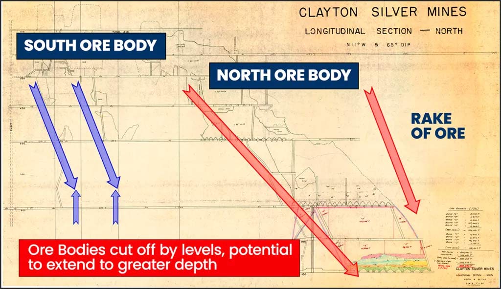
Two major ore bodies were partly mined: the “South Ore Body” and the “North Ore Body”. Both are tabular ore bodies raking northeast to depth. Production was initiated on the South Ore Body and development extended to the North Ore Body. Mineralization is open to the north, the south and to depth, all of which is untested. For example, there is potential for resources to exist at shallower depths below and adjacent to the South Ore Body.
Historical records indicate the South Ore Body was mined from the 100-foot level to the 800-foot level, while the North Ore Body was mined from the 100-foot level to the 1,100-foot level. Internal mine records from 1966 indicate a resource of 597,075 tonnes between the 800-foot level and 1300-foot level, having a weighted average grade of 3.83 oz Ag/t. Values for lead and zinc were not disclosed. Underground development on the 800-foot level was extended to the North Ore Body, with subsequent development down to the 1100-foot level to access the ore.
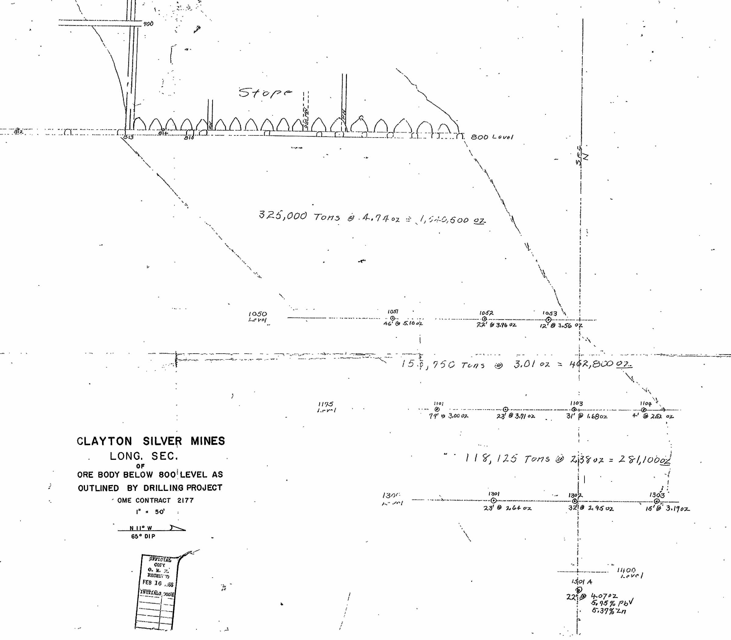
Mine Longitudinal Section
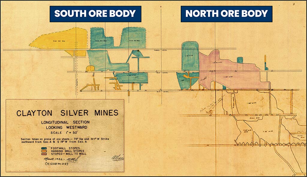
Records indicate that as of January 1, 1982, there were approximately 458,590 tonnes of ore identified between the 800 and 1100 foot levels. Of this resource, 52,800 tonnes were mined in 1983, 76,110 tonnes in 1984 and 102,258 in 1985, suggesting 227,422 tonnes have not been mined. Additional tonnage identified down to the 1530-foot level was not mined and, therefore, is interpreted to remain available. Significant potential is demonstrated in hole 1501-A, drilled in the mid-1960’s, which penetrated the mineralized zone at 1,425 feet. At that depth, the hole intercepted 22 feet of 4.07 oz Ag/t, 5.75% lead and 5.37% zinc (note: true width is unknown).
Mine Historical Ore Bodies
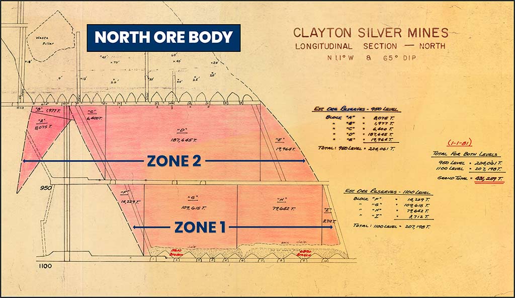
Zone 1 Ore: Three Shoots
Localized between Hanging wall (H) and Footwall (F) Faults
Zone 2 Ore: Four Shoots
Recognized from Hanging wall in 1986, therefore:
- Probably NOT represented in Resource
- Probably NOT exploited to significant degree
1964 and 1965 drillhole locations to explore the mineralization below the 800 ft. level of the Clayton Mine
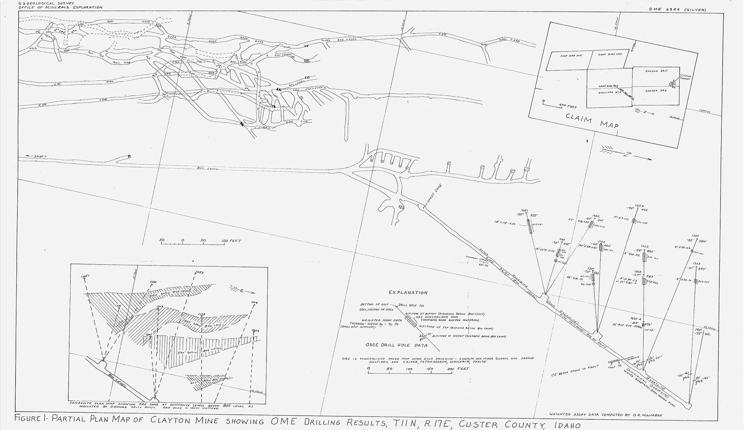
Longitudinal Section Through Ore Shoot Showing OME Drillholes
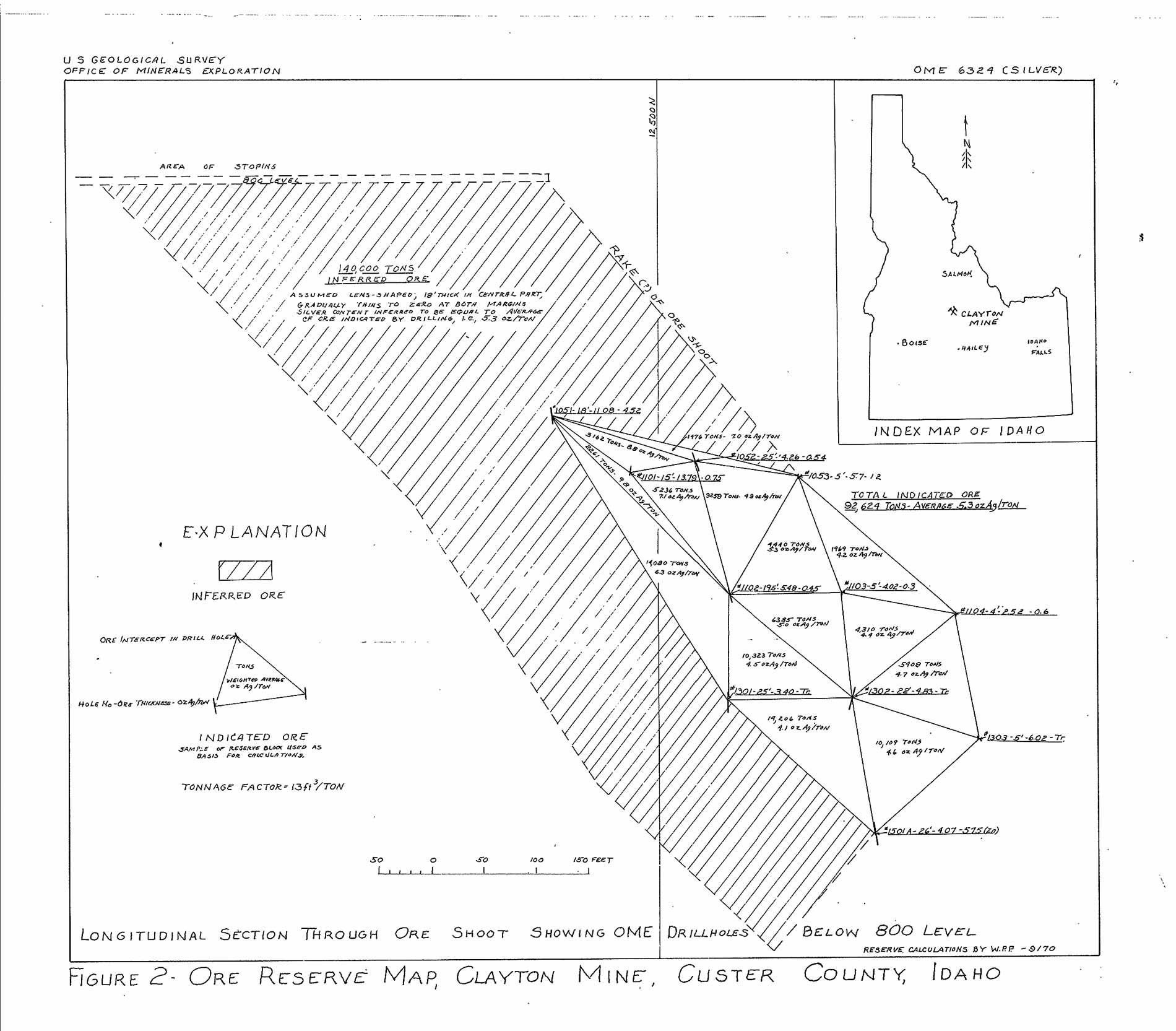
Ore Body Below 800 Level as Outlined by Drilling Project
Hillman (1986) Figure 10
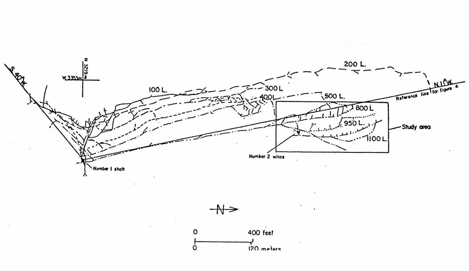
Clayton Silver Mine, plan view of underground workings showing the area studied by Hillman (1986)
Hillman (1986) Figure 11
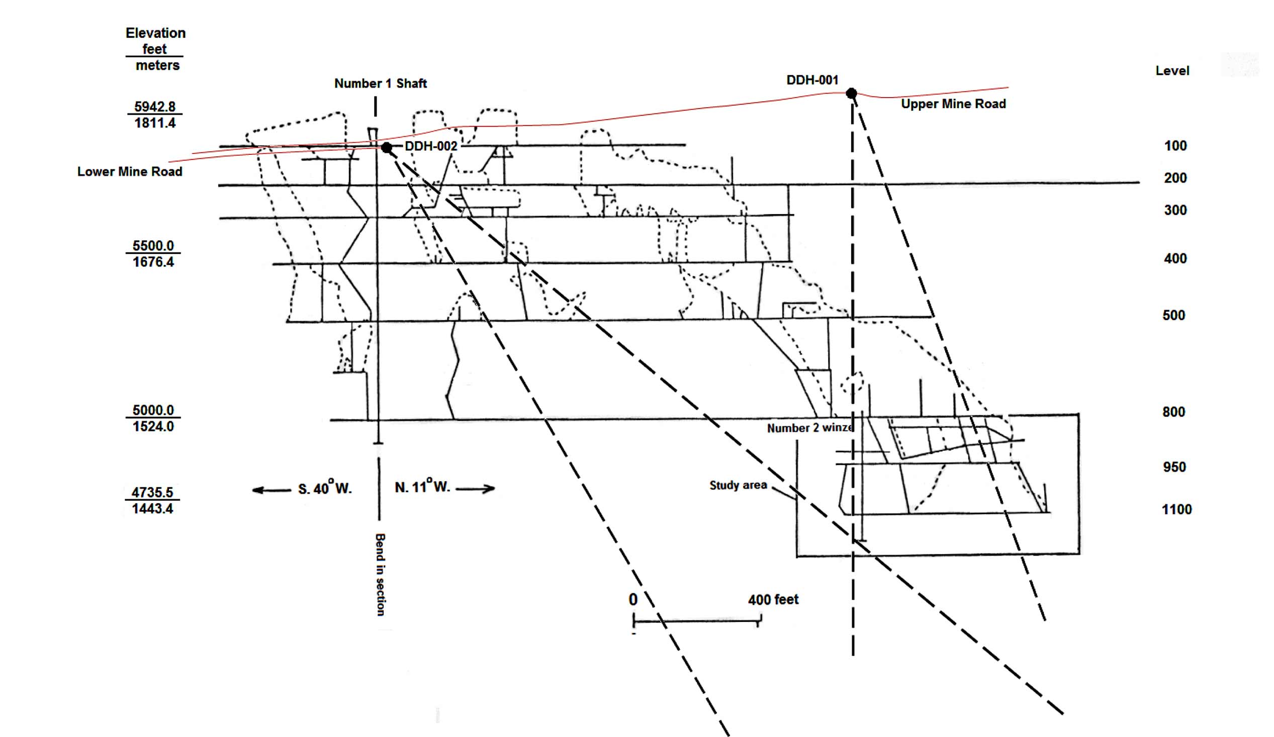
Clayton Silver Mine, longitudinal section of the underground workings showing stoped areas (dashed lines) and Hillman (1986) study area. The locations of proposed drill locations are also shown.
Hillman (1986) Figure 12
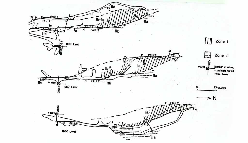
Clayton Silver Mine with mineralization in plan view for the north 800, 950 and 1,100 ft. levels. Hillman (1986) mapped and examined, as part of his Master’s Thesis, rocks in one of two mineralized shear zones that were explored and developed at the mine. The Clayton shear zone, at depth, separates the mineralization into two zones, which Hillman (1986) called Zones I and II, with seven identified mineralized shoots (Ia, Ib, Ic in Zone I and IIa, IIb, IIc, IId in Zone II). The Clayton shear zone developed post mineralization.
Hillman (1986) Figure 13
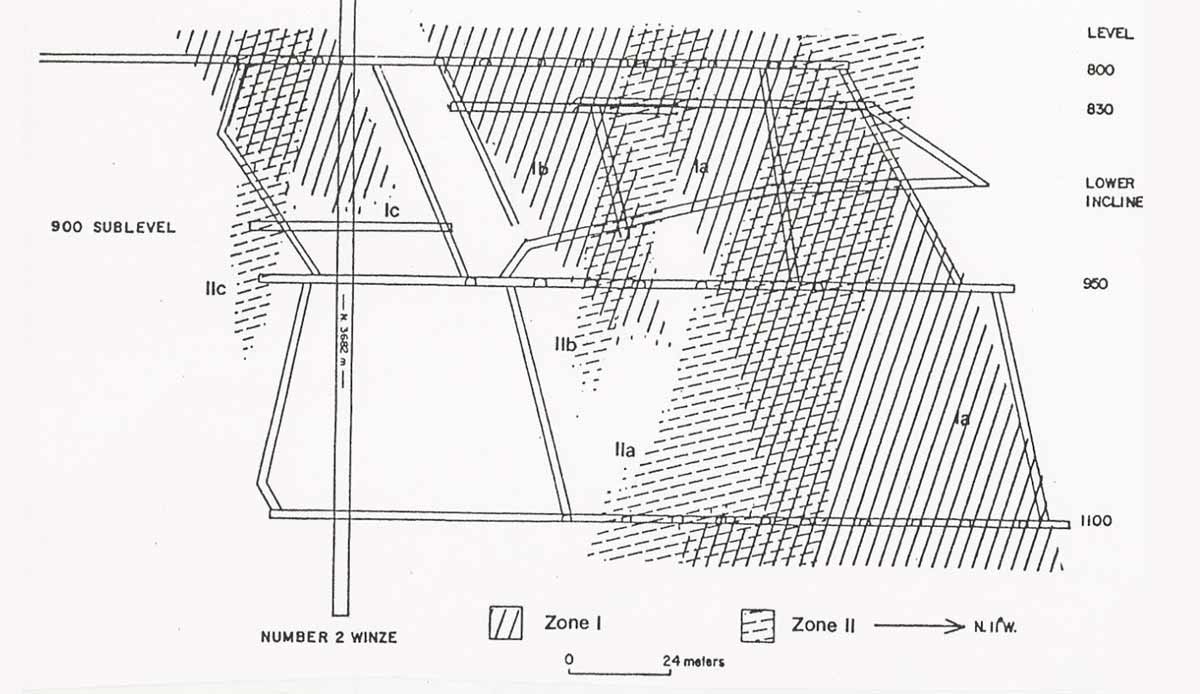
Clayton Silver Mine longitudinal showing mineralized shoots projected to the hanging wall fault. The two zones have similar mineralogy, but differ in terms of their structural orientation as described in Hillman (1986). At the time of his report, the mineralization in Zone I had been mined continuously to the 1,100 ft. level. He states that, based on drill intersections, it is known to extend at least 427 ft. (130 m.) below the 1,100 ft. level. The strike length of the mined zone averages 410 ft. (125 m.) for all levels and the width is variable due to the nature of replacement. The economic potential of Zone II had only recently been recognized at the time of Hillman’s work. Massive sulfide lenses associated with areas of massive siderite replacement in Zone II (similar to those in Zone I) yielded the highest silver grades encountered by Hillman (1986).
Additional Exploration Plans
- Geophysics to identify new anomalies.
- Initial shallow diamond drilling program to test targets in vicinity of South Ore Body
- Further drilling to test for new veins parallel to existing mine workings
- Conduct further drilling programs on Clayton property with the objective of determining total resource potential to support a Preliminary Economic Assessment
- Leverage drilling results to test for source of mineralization with potential of discovering a deeper world class deposit.
Long Term Objectives
- Build a modern, efficient custom mill.
- Refurbish/rebuild the historic underground mine workings
- Reactivate mining operations at the Clayton Silver Mine
- Investigate other potentially economic mining opportunities in the vicinity
Additional Exploration Plans
- Geophysics to identify new anomalies.
- Initial shallow diamond drilling program to test targets in vicinity of South Ore Body
- Further drilling to test for new veins parallel to existing mine workings
- Conduct further drilling programs on Clayton property with the objective of determining total resource potential to support a Preliminary Economic Assessment
- Leverage drilling results to test for source of mineralization with potential of discovering a deeper world class deposit.
Long Term Objectives
- Build a modern, efficient custom mill.
- Refurbish/rebuild the historic underground
mine workings - Reactivate mining operations at the Clayton Silver Mine
- Investigate other potentially economic mining opportunities in the vicinity
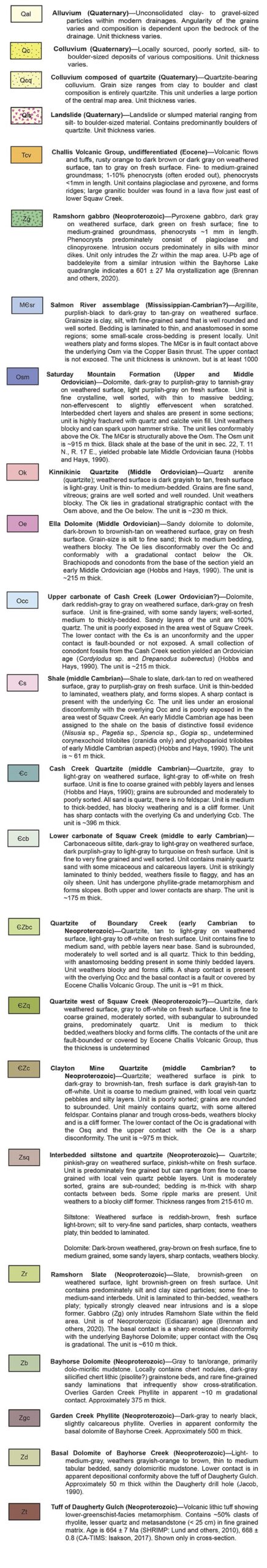
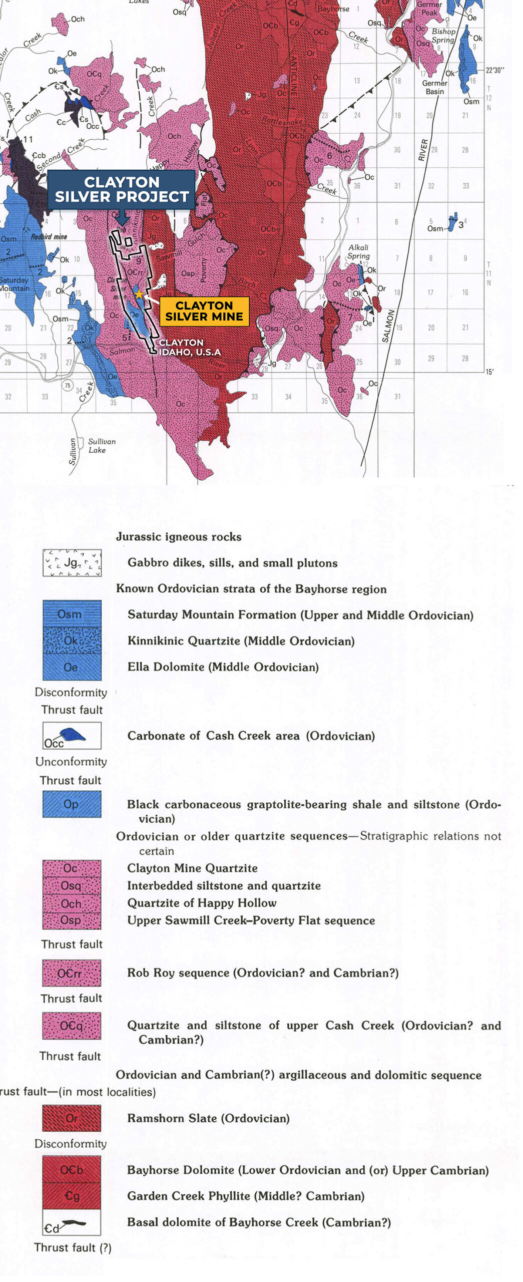
GEOLOGY
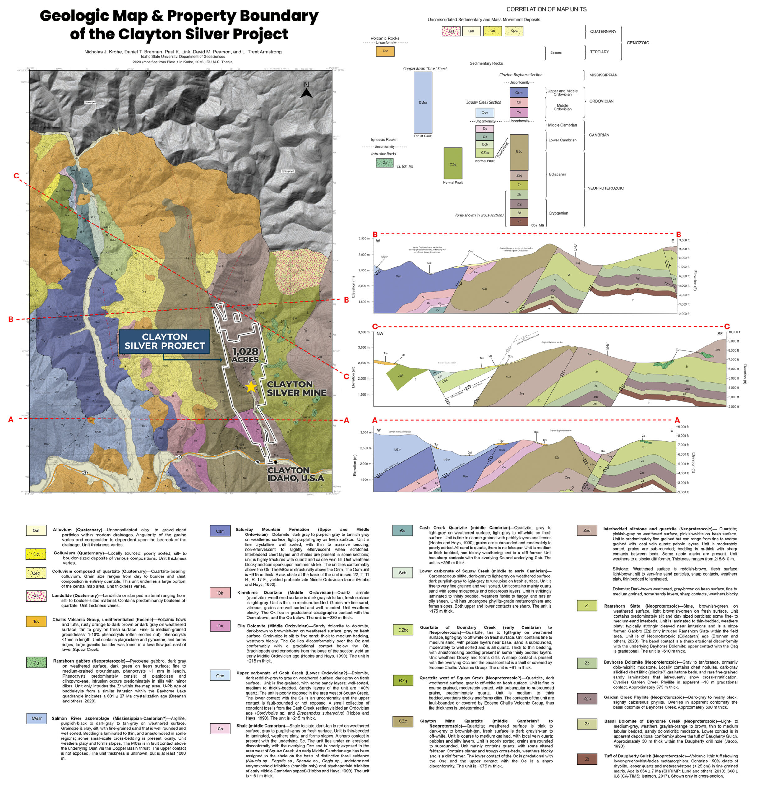
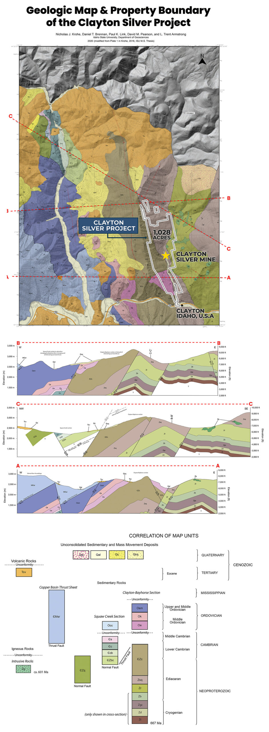
LEGEND
Challis Volcanics
The Challis Volcanics Zone in Idaho is a geologically significant region characterized by a diverse range of volcanic rocks and associated mineral deposits. This volcanic zone is part of the larger Challis Magmatic System, which spans across central Idaho.
The Challis Volcanics Zone primarily consists of volcanic and sedimentary rocks formed during the Eocene epoch, approximately 50 million years ago. The region exhibits a complex geological history, featuring lava flows, ash deposits, and volcaniclastic rocks.
One notable area within the Challis Volcanics Zone is Clayton, Idaho, which is known for its rich mineral resources. The region is abundant in various minerals, including gold, silver, copper, and molybdenum. Gold and silver, in particular, have been mined for centuries, contributing to both historical and contemporary mining operations. The Challis Volcanics Zone serves as a valuable geological resource, providing economic opportunities and contributing to the broader mineral supply chain.
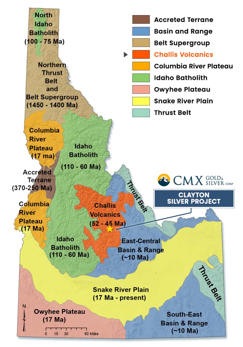
Challis Volcanics
Rock Types at the Clayton Silver Project
Economic minerals mined in the Bayhorse Mining District occur in mineralized shear zones or as replacement lenses in calcareous rocks. The host rocks from most of the mines in the district are the Ramshorn Slate and the Bayhorse Dolomite. Some of the deposits are associated with granitic intrusive rocks. Sulfides, such as galena, sphalerite, pyrite, tetrahedrite and chalcopyrite are found in the deposits. Both the galena and tetrahedrite are argentiferous. Fluorspar deposits have also been exploited in some of the mines. At the Clayton Silver Mine, Pb-Zn-Cu-Ag mineralization occurs in replacement and open space filling deposits, which show both structural and stratigraphic controls. The tabular mineralized zones are associated with shear zones that are parallel to the bedding of a quartz-rich horizon within the Ella Dolomite. Folding and faulting have altered the original nature of the mineralization. The mineralized shoots are characterized by galena, pyrite, sphalerite, tetrahedrite, chalcopyrite, pyrargyrite, and arsenopyrite, which are developed in a siderite gangue. During the 50 or so years of operations, several mineralized areas have been developed within the Clayton Silver Mine.
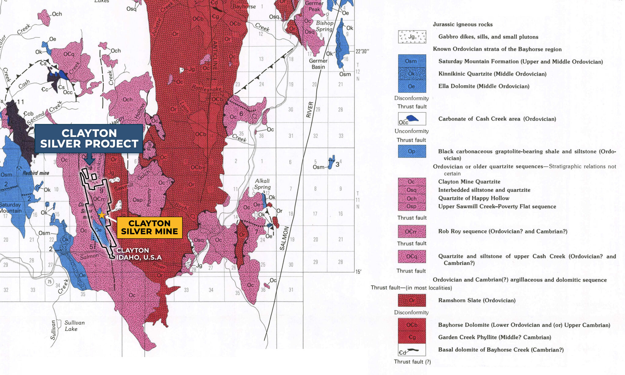